
Visualization of Plot/Parcel Boundary
Experience Land Management in High Definition
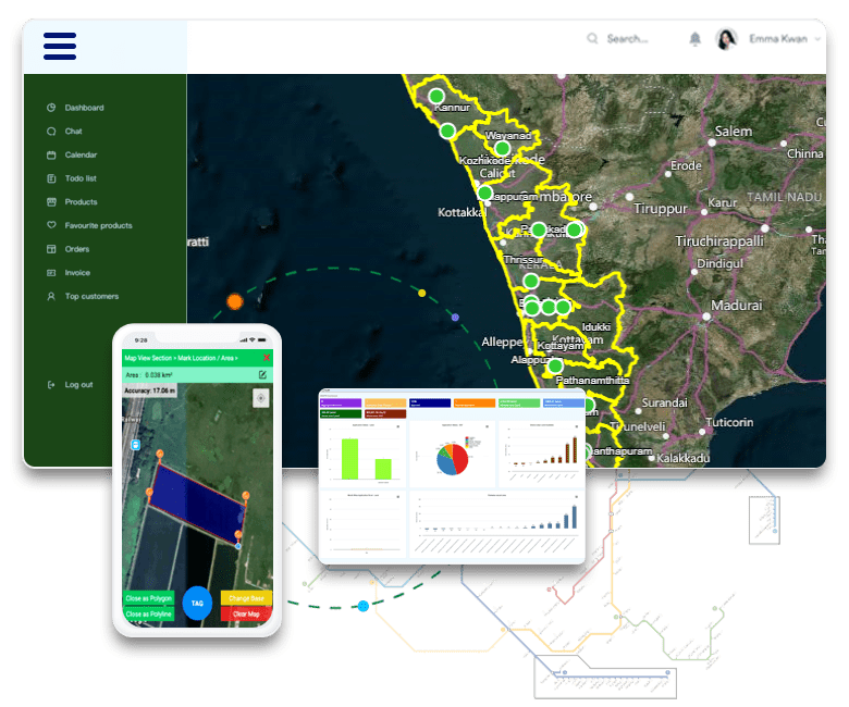
LAMS empowers you with the ability to visualize plot and parcel boundaries like never before. Say goodbye to traditional paper maps and embrace the future of land management with our cutting-edge technology.
- Lease Tracking : See your land plots with incredible accuracy overlaid on top of satellite imagery or Google Earth. Gain a bird's-eye view of your land assets.
- Enhanced Decision-Making : Make informed decisions by visualizing land boundaries in real-time. Identify potential issues or opportunities with ease.
- Effortless Monitoring : Keep an eye on your land plots from anywhere, ensuring they align perfectly with your plans.
- Streamlined Communication : Share visualized plot boundaries seamlessly with stakeholders, reducing misunderstandings and streamlining collaboration.
With LAMS, you're not just managing land, you're experiencing it in its full visual glory. Explore the future of land management today.
Land Acquisition Process Management
Efficiency Meets Compliance
Managing land acquisition processes as per state-wise LARR Acts has never been more streamlined. LAMS offers a comprehensive solution to navigate the complexities of land acquisition seamlessly.
- Compliance Assurance : LAMS ensures compliance with state-wise LARR Acts, keeping you in adherence with regulatory requirements.
- Gantt Chart and Timeline Tracker : Stay in control of land acquisition projects with our Gantt Chart and Timeline Tracker. Plan, monitor, and adjust timelines effortlessly.
- Responsible Person/Team Monitoring : Assign responsibilities, track progress, and ensure accountability with our responsible person/team monitoring feature.
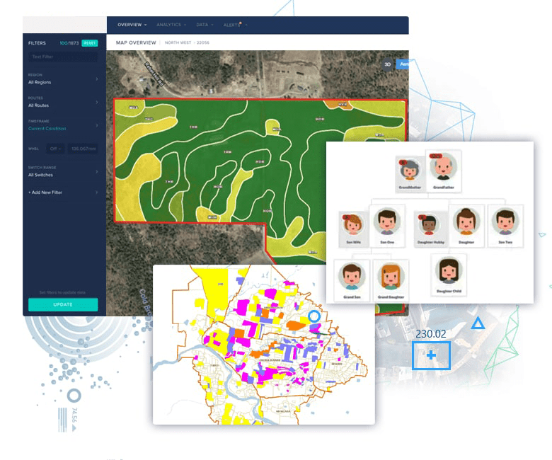
- Color-Coded Thematic Maps : Visualize land acquisition status with color-coded thematic maps. Instantly understand the allocation, acquisition, and progress of land.
With LAMS, you not only manage land acquisition efficiently but also ensure compliance and transparency throughout the process. Experience a new level of control and insight.
Land Ownership Management
Transparency and Control in Land Ownership
LAMS redefines how you manage land ownership. Gain unparalleled transparency, from tracking and updating plot owner details to mapping intricate family trees and stakeholder relationships.
- Plot Owner Details : Keep comprehensive records of plot owners, ensuring accuracy and ease of management.
- Family Tree Mapping : Visualize the interconnected web of land ownership with our family tree mapping feature. Understand the dynamics at a glance.
- Stakeholder Management : Efficiently manage stakeholders associated with land ownership, facilitating seamless communication and collaboration.
- Compensation and R&R Benefits : Streamline compensation and other Resettlement and Rehabilitation (R&R) benefits. Ensure timely and fair disbursements.
With LAMS, you have a comprehensive toolkit to manage land ownership, maintain transparency, and ensure that every stakeholder is accounted for. Elevate your land management capabilities with ease.
Land Valuation
Empower Your Land Decisions with Real-Time Valuation Insights
LAMS keeps you in the know when it comes to your land's value. With our real-time valuation tools, you're always up to date, ensuring your decisions are based on the latest data.
- Real-Time Valuation : Gain access to up-to-the-minute land valuations, allowing you to make informed decisions quickly.
- Asset Consideration : LAMS takes into account various assets associated with your land, providing a comprehensive valuation that goes beyond just the plot.
- Tax and Fee Calculation : Enjoy the convenience of automated tax and fee calculations, notification about due dates and ensuring financial compliance effortlessly.
With LAMS, you're not just managing land, you're maximizing its potential. Stay updated, stay informed, and make land decisions with confidence.

Land Lease Management
Efficiently Handle Your Land Leases
LAMS simplifies the management of land leases, ensuring that you maintain control and compliance while optimizing your leasing operations.
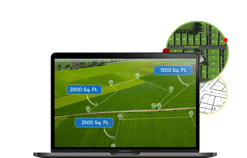
- Lease Tracking : Keep a meticulous record of all your land leases in one central location, making tracking and monitoring effortless.
- Lease Terms Management : Stay on top of lease terms, renewals, and expirations. Receive timely alerts to prevent oversights.
- Financial Efficiency : Streamline lease-related financial transactions, ensuring payments, invoicing, and receipts are managed seamlessly.
- Legal Compliance : Ensure that your land leases are in compliance with relevant legal requirements and regulations.
- Integration Possibilities : Integrate our land lease management module with your existing financial systems for added efficiency.
With LAMS, you have the tools to maximize the value of your land leases while maintaining the highest level of control and compliance. Simplify your land lease management today.
Litigation Management
Effortless Handling of Legal Matters
LAMS provides you with a robust solution to manage litigation, arbitration, and court cases associated with your land assets. Say goodbye to legal complexities, and confidently navigate the legal landscape.
- Case Tracking : Keep a comprehensive record of all legal cases related to your land, ensuring you never miss a deadline or important event.
- Document Management : Easily manage and access all legal documents, court filings, and correspondence, streamlining your legal workflow.
- Stakeholder Communication : Facilitate communication with legal stakeholders, including advocates and legal teams, within a centralized platform.
- Resolution Monitoring : Track the progress of litigation and arbitration cases, from filing to resolution, ensuring transparency and accountability.
- Alerts and Reminders : Receive timely alerts for court hearings, case updates, and important deadlines.
With LAMS, you have the tools to effectively manage legal matters, maintain compliance, and navigate the legal landscape with confidence.

Encroachment Detection & Tracking
Protect Your Land Assets with Precision
LAMS employs cutting-edge technology to safeguard your land assets against encroachments. Our advanced change detection techniques, powered by remote sensing and topographical feature extraction, offer unmatched protection.
- Change Detection : LAMS analyses multiple satellite images of the same area over time, identifying even subtle changes in land boundaries and usage.
- Precision Monitoring : Ensure the accuracy of your land assets' boundaries and detect encroachments promptly to take necessary actions.
- Transparent Reporting : Receive detailed reports on detected changes and encroachments, allowing for informed decision-making.
- Proactive Protection : Stay one step ahead in protecting your land by addressing encroachments before they become significant issues.
With LAMS, you have an intelligent and proactive solution to protect your land assets from encroachments, ensuring their integrity and value.
Financial Module
Comprehensive Financial Management for Land Transactions
LAMS introduces a comprehensive Financial Module designed to simplify financial transactions related to land purchase, sale, compensation, Resettlement and Rehabilitation (R&R) expenses, lease payments, and regulatory taxes and fees. With LAMS, your financial operations become more efficient, accurate, and transparent.
- Payment Management : Seamlessly handle payments for land purchase and sale, ensuring timely and accurate transactions.
- Lease Payments : Easily manage and track lease payments, ensuring compliance with lease agreements.
- Compensation Calculations : Calculate compensation for land acquisition, considering not only the land plot but also the assets within the land, providing a comprehensive view of financial obligations.
- R&R Expenses : Efficiently manage and track expenses related to Resettlement and Rehabilitation (R&R) projects, ensuring financial compliance.
- Regulatory Tax and Fee Management : Stay compliant with regulatory requirements by managing and tracking taxes and fees associated with land transactions.
- Financial Transparency : Gain full visibility into your financial transactions, reducing errors and ensuring compliance with financial regulations.
- Integration Possibilities : Integrate LAMS' Financial Module with your existing financial systems, such as SAP, MS Navision, Tally, Salesforce, and more.
With LAMS, you have a powerful financial management tool at your disposal, ensuring that your land transactions, lease payments, and regulatory tax and fee obligations are handled with precision and efficiency.

Data Analytics, Reports and Dashboard
Unleash the Power of Data for Informed Decisions
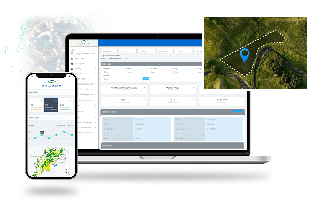
LAMS takes your land information to the next level with robust data analytics, dynamic reports, and customizable dashboards. Transform raw data into actionable insights and elevate your land management game.
- Data Analytics : Harness the potential of your land data with advanced analytics tools. Gain deeper insights, spot trends, and make data-driven decisions.
- Customizable Reports : Create and generate custom reports tailored to your specific needs. Access critical information at your fingertips.
- Dynamic Dashboards : Visualize your data with interactive and user-friendly dashboards. Monitor key performance indicators and track progress effortlessly.
- Real-time Information : Access the latest information instantly, ensuring that your decisions are based on the most up-to-date data.
- Comprehensive Insights : From land acquisition progress to financial performance, get a 360-degree view of your land management operations.
- User-Friendly Interface : Navigate through data, reports, and dashboards with ease, even if you're not a data expert.
With LAMS, you're not just managing land, you're mastering it. Empower your team with data-driven decision-making and stay ahead of the curve.
Geospatial Analytics & Visualization
Unlock Insights with Comprehensive Geospatial Intelligence
LAMS combines a rich array of features in Geospatial Analytics & Visualization to provide you with invaluable insights into your land assets. Our multifaceted approach allows you to see your land from multiple angles and make data-driven decisions.
- Geospatial Insights : Analyse land data through geospatial intelligence, uncovering patterns, trends, and opportunities that traditional data analysis might miss.
- High-Resolution Visualization : See your land assets in vivid detail. Understand land boundaries, topography, and assets with precision through high-resolution geospatial visualization.
- Multi-Location Mastery : Visualize your multilocational land banks across the country with a micro to macro view. Effortlessly manage vast land portfolios.
- Plot-Wise Cadastral Maps : Explore plot-wise cadastral maps with overlaid administrative boundaries, water bodies, habitations, roads, railways, and more for comprehensive insights.
- Thematic Mapping : Gain insights at a glance with thematic color-coded maps based on land type, allotment status, acquisition progress, encroachments, and more.
- Digitized Resettlement Maps : Access digitized maps of resettlement colonies, complete with occupied status of Project-Affected Families (PAF) details.
- Satellite Integration : Leverage the power of satellite images and integrated maps like Google and Bing Maps as a background for precision in land management.
- Change & Encroachment Detection : Detect changes and encroachments using topographical feature extraction of satellite imagery, ensuring the security of your land assets.
- Offline Mobile Access : Access geospatial data even in areas with no network connectivity with our offline mobile app for field-level data capture. Stay connected to your land insights, wherever you are.
With LAMS, our Geospatial Analytics & Visualization features become your comprehensive toolkit. Elevate your land management strategy with actionable insights, visual clarity, and the power to make informed decisions, no matter where your land assets are located.
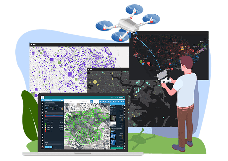

Administrative Control
Effortless Management and Security for Administrative Operations
LAMS provides you with robust Administrative Control capabilities, ensuring seamless management, stringent security measures, and customizable control over your land management system. Take charge of your operations confidently.
- Rule and Role-Based Authentication : Implement secure access control with rule and role-based authentication, ensuring users have appropriate permissions based on their roles within the organization.
- Data Segregation : Maintain strict data privacy. Data from one location/unit remains confidential and cannot be accessed or visualized by other locations. However, administrators at the group level can view aggregated data for comprehensive insights.
- Password and OTP Security : Strengthen user access security with dual authentication layers, including passwords and One-Time Passwords (OTP), enhancing system integrity.
- OAuth-Based Security : Leverage OAuth-based security protocols for reliability and secure interactions with external applications and services.
- Customizable Master Lists : Adapt the system effortlessly to changing requirements by customizing master lists for input forms, ensuring that your forms remain up-to-date without sacrificing functionality.
- User Management : Streamline user management with intuitive tools for both web users and mobile users. Add, modify, or remove users with ease, ensuring your system stays aligned with your organization's structure.
- User Rights Management : Define granular user rights, specifying which users have access to which locations, modules, data, and more. Ensure compliance and maintain data security.
- Audit Trails : Keep comprehensive records of user activities and changes made within the system, maintaining transparency and accountability.
With LAMS Administrative Control feature, you have the tools to manage users, data, and system settings with precision and confidence. Ensure compliance, maintain security, and tailor the system to your unique needs effortlessly.
Customization and Configuration
Tailor LAMS to Fit Your Unique Needs
One of the standout qualities of LAMS is its adaptability. We understand that large corporations have diverse approaches to land management, which can vary from one company to another, from state to state, and from country to country. LAMS offers extensive customization and configuration options, allowing you to align the system precisely with your organization's policies, whether for land management or Resettlement and Rehabilitation (R&R).
- Tailored Solutions : Customize LAMS to match your company's specific land management requirements, accommodating variations in policies and procedures.
- Flexibility Across Locations : Ensure that LAMS adapts seamlessly to your organization's diverse operations, whether you operate at the state, national, or international level.
- Policy Alignment : Align the system with your company's policies, ensuring that every aspect of land management and R&R complies with your standards.
- Configurable Modules : Modify modules to suit your unique workflows, adding or removing features as needed.
- Customizable UI/UX : Tailor the user interface and user experience (UI/UX) of LAMS to reflect your organization's branding, preferences, and user expectations.
- Integration Possibilities : Seamlessly integrate LAMS with other software solutions, such as ERP systems (SAP, MS Navision, Tally, Salesforce), enhancing cross-functional capabilities and data flow.
- Continuous Support : Benefit from ongoing support and updates, ensuring that your customized system remains current and effective.
- Scalable Solutions : As your organization evolves, LAMS grows with you. Scale the system to meet changing requirements and accommodate growth.
- Enhanced Efficiency : Streamline operations by configuring LAMS to optimize processes and workflows, enhancing overall efficiency.
- Enhanced Efficiency : Streamline operations by configuring LAMS to optimize processes and workflows, enhancing overall efficiency.
With LAMS, you have the freedom to configure, customize, and integrate the system to match your company's unique approach to land management and R&R. Additionally, you can tailor the user interface and user experience, fostering seamless collaboration with other software solutions while delivering a personalized and intuitive interface for your users.

Contact Us
Ready to elevate your land management experience with LAMS? Get started today to experience the future of land management firsthand. Contact us for a demo, request a quote, or explore our solutions to see how LAMS can transform the way you manage your land assets.
