What We Do
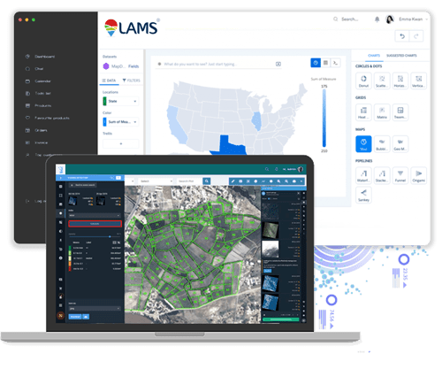
In the realm of land management, access to high-quality and up-to-date satellite imagery is invaluable. At LAMS, we understand the significance of visual data in making informed decisions. That's why we offer Satellite Image Procurement services, allowing you to leverage the power of advanced imagery for your land management needs.
Our Satellite Image Procurement Services Include
-
Access to Leading Providers
Through our partnerships with renowned data providers like NRSC, Planet, Maxar, Airbus, and more, we ensure that you have access to the latest and most reliable satellite imagery. These partnerships enable us to offer a wide range of satellite data options tailored to your specific requirements.
-
High-Quality Imagery
We prioritize high-quality imagery that provides clear, detailed views of your land parcels, project sites, and other areas of interest. Our imagery supports accurate analysis, planning, and decision-making.
-
Frequent Updates
Timely access to updated satellite imagery is essential for tracking changes on the ground. Our services include regular updates to ensure that your data reflects the most current conditions.

Frequently Asked Questions
Our Satellite Imageries Service offers advanced satellite data for comprehensive land management. By leveraging high-resolution imagery, this service provides detailed insights into land use, topography, vegetation, and infrastructure, helping in effective decision-making for land acquisition, monitoring, and development projects.
-
What Types of Satellite Imageries are Available?
We offer different types of satellite imagery, including:
-- Optical imagery (multi-spectral and high-resolution)
-- Infrared imagery
-- Radar imagery
-- Stereo imagery for 3D analysis We provide resolutions ranging from 30 cm to 1 meter, depending on your project requirements. -
How Do I Know What Resolution is Suitable for My Project?
The resolution you need depends on your project's purpose:
-- 30 cm resolution is ideal for detailed land surveys, infrastructure, and urban development.
-- 50 cm to 1 meter resolution works well for cadastral mapping, agricultural mapping, environmental monitoring, and general land use applications. -
What is the Cost of Satellite Imagery?
Costs depend on the resolution, area of interest (AOI), and type of satellite data you require. We will provide a customized quotation based on your specific needs.
-
How Do You Ensure the Accuracy of the Satellite Images?
We provide georeferenced satellite images, ensuring high positional accuracy. For higher accuracy needs, we can offer additional processing, such as orthorectification or ground control point integration.
Contact Us
Ready to elevate your land management experience with LAMS? Get started today to experience the future of land management firsthand. Contact us for a demo, request a quote, or explore our solutions to see how LAMS can transform the way you manage your land assets.
